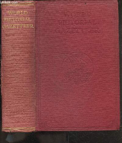
The World pictorial gazetteer and atlas - over 1500 maps and illustrations - encyclopedia of all countries, their natural features and resources, their cities, towns, villages, and historic places, and the native races of the world, embodying about ... de HAMMERTON J.A. (sir) | Achat livres - Ref RO20253581 - le-livre.fr

Achetez cet articleThe world pictorial gazetteer and atlas - over 1500 maps and illustrations - encyclopedia of all countries, their natural features and resources, their cities, towns, villages, and historic places, and the native races of the world, embodying about ...

Achetez cet article issu de nos LivresThe world pictorial gazetteer and atlas - over 1500 maps and illustrations - encyclopedia of all countries, their natural features and resources, their cities, towns, villages, and historic places, and the native races of the world, embodying about ...
RO20253581

Caractéristiques détaillées

Auteur Hammerton j.a. (sir)
Editeur FLEETWAY HOUSE
Impression Non daté
Etat Etat d'usage
Disponibilité 1 en stock
Prix
  • 39,80 €
Référence RO20253581
Classement Dewey 420
Fiche créée le 25/10/2023
Description
FLEETWAY HOUSE. non daté. In-8. Relié toilé. Etat ... Plus d'informations.

Commander ce produit

Acheter cet article
39,80 €

Satisfait ou remboursé

14 jours pour changer d’avis

Envoi sous 48h

Expédition du Lundi au Vendredi, toute l'année.

Paiement à l’expédition

Le montant de votre achat est prélevé à l’expédition

Support chat ou téléphone

Discuter avec des experts ou vous appeler immédiatement

En stock du même auteur

Description du produit

The world pictorial gazetteer and atlas - over 1500 maps and illustrations - encyclopedia of all countries, their natural features and resources, their cities, towns, villages, and historic places, and the native races of the world, embodying about ... par Hammerton j.a. (sir)

FLEETWAY HOUSE. non daté. In-8. Relié toilé. Etat d'usage, Couv. légèrement passée, Mors fendus, Quelques rousseurs. 1024 pages - texte en anglais, sur deux colonnes - nombreuses illustrations en noir/blanc, dans et hors texte - dos insolé - annotations au crayon à papier en page de titre. . . . Classification Dewey : 420-Langue anglaise. Anglo-saxon

Informations Supplémentaires

The World pictorial gazetteer and atlas - over 1,500 maps and illustrations - encyclopedia of all countries, their natural features and resources, their cities, towns, villages, and historic places, and the native races of the world, embodying about 20,000 separate articles Classification Dewey : 420-Langue anglaise. Anglo-saxon

Vos derniers articles vus
L'historique de vos consultations a été effacé.
Souhaitez vous continuer à sauvegarder vos consultations ?